
Manual contents
User manual
Review, search & organize
Explore Record List and Record Detail, search, and organize with titles, notes, and tags.
Open a record from Record List
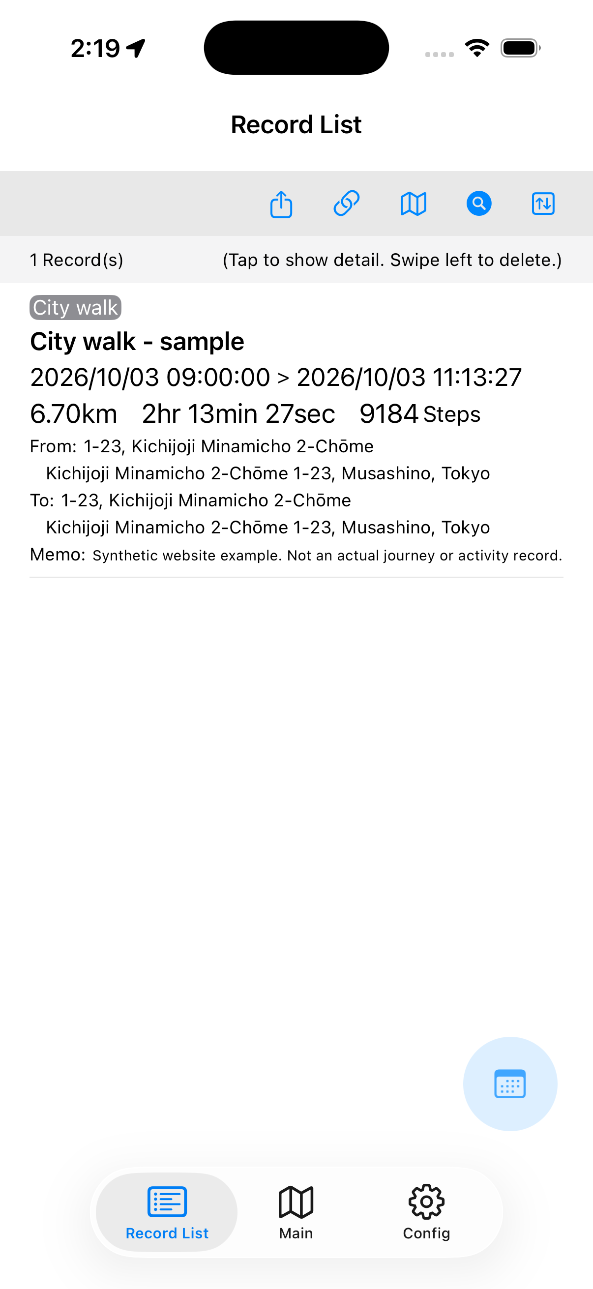
Open Record List at the bottom of the screen. Each record shows start and finish dates, distance, duration, steps, and start and finish locations. Tap the record you want to open.
Use the top sort button to sort by start date, distance, duration, or steps in ascending or descending order. Newest start date is the default.
The calendar button helps find records by the day they were recorded.
A search filter may still be active. Open search and choose Clear Search Condition to show all records again.
Explore maps, points, and charts
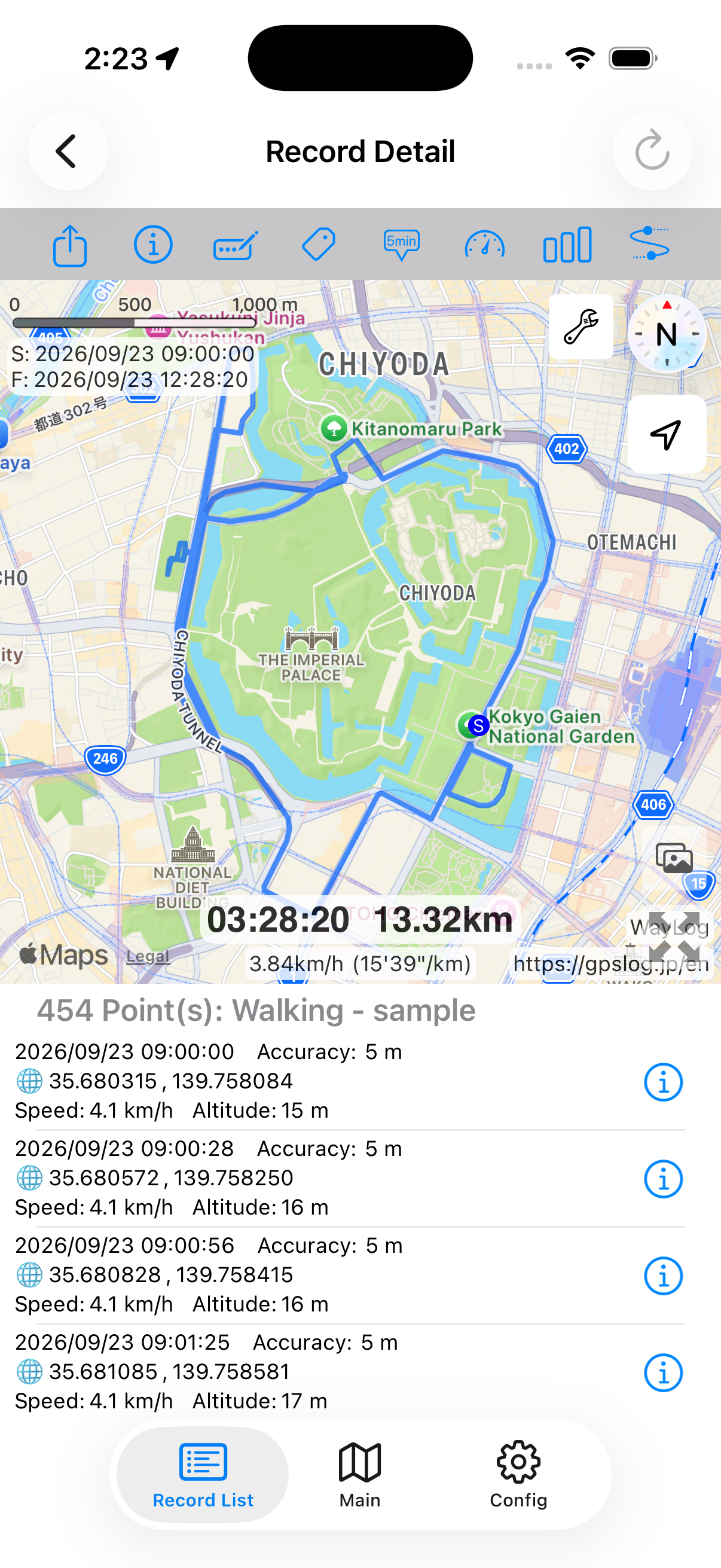
Record Detail has a map above and a list of recorded points below. S marks the start; F marks the finish on the map.
The bar-chart button switches between the point list and charts. Choose Distance, Speed, or Altitude above the chart.
The information (i) button shows start and finish times, duration, distance, average speed and pace, steps, and start and finish locations.
Select a point in the list or on the map to see its time, coordinates, speed, and altitude. Location errors can affect values and route shape.
Search by date, keyword, or tag
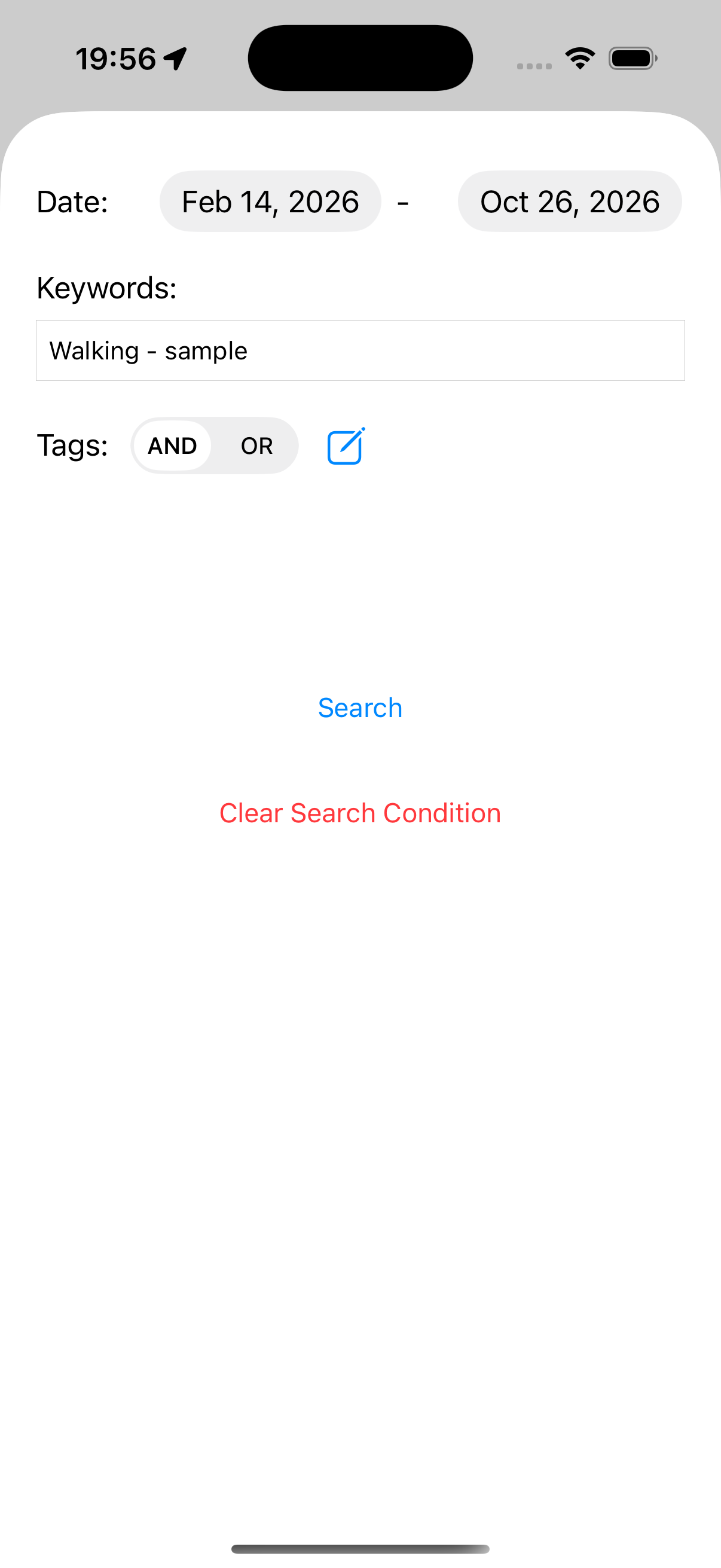
- In Record List, tap the search button.
- Set a date range, keyword, or tags.
- Tap Search to show only matching records.
Keywords search record titles, notes, and start and finish location names or addresses. Multiple tags can use AND (all tags) or OR (any tag).
To show all records again, tap Clear Search Condition.
Add a title or note
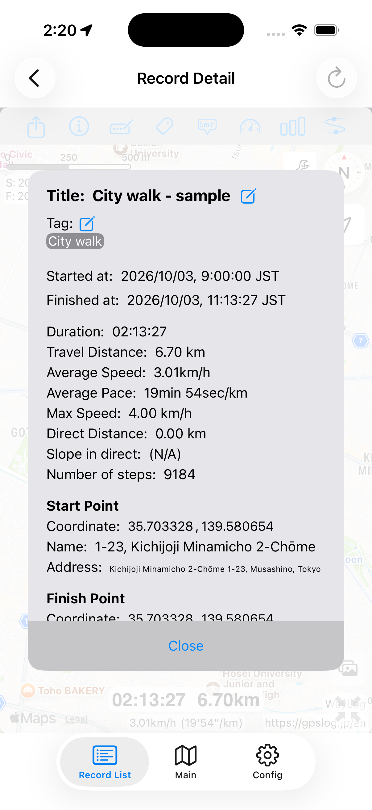
A title makes a record easier to find in the list. In Record Detail, use the pen-shaped title button or the edit button beside Title in the information screen. Enter a title and tap Save.
For a note, use Information (i) → the edit button beside Memo and enter details such as places, detours, or discoveries that the map alone does not capture.
Organize with tags
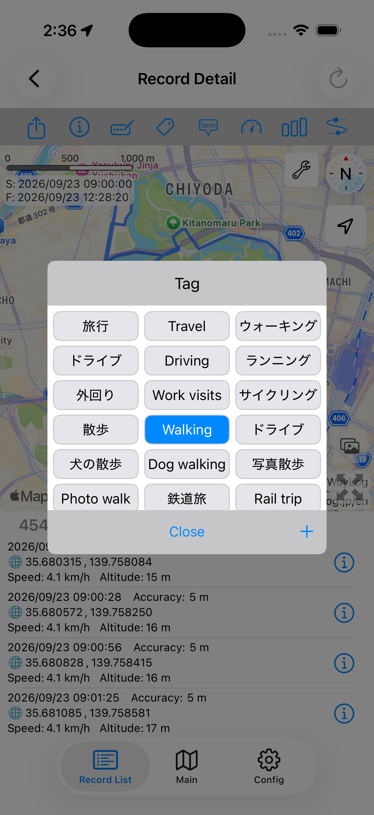
- In Record Detail, tap the tag-shaped button.
- Select the tags you want. Tap a selected tag again to remove it.
- Tap Close to return.
Use Add to create a new tag. To manage tag names and the list, open Config → Tag Management.
A record can have multiple tags. Separating purpose and place can make tag searches more useful.
Explore the map in detail
- Elapsed-time markers
- Show map positions corresponding to elapsed times during the trip.
- Color by speed
- Color the route according to speed, from green for slower parts to red for faster parts.
- Information between two points
- Open section selection, choose the first and last points from the point list, and confirm each selection. Review time, distance, speed, slope, and other values for the selected section.
- Photos
- The photo button shows geotagged photos taken during the recording period on the map. Photo access permission and photo timestamps and location data are required.
- View multiple records on one map
- Use Record List's map button to show all records or select which to display. You can also review records narrowed down by a search.
For overlaying previous routes on Main, see Sharing & data management for details.