
Save the boat's route
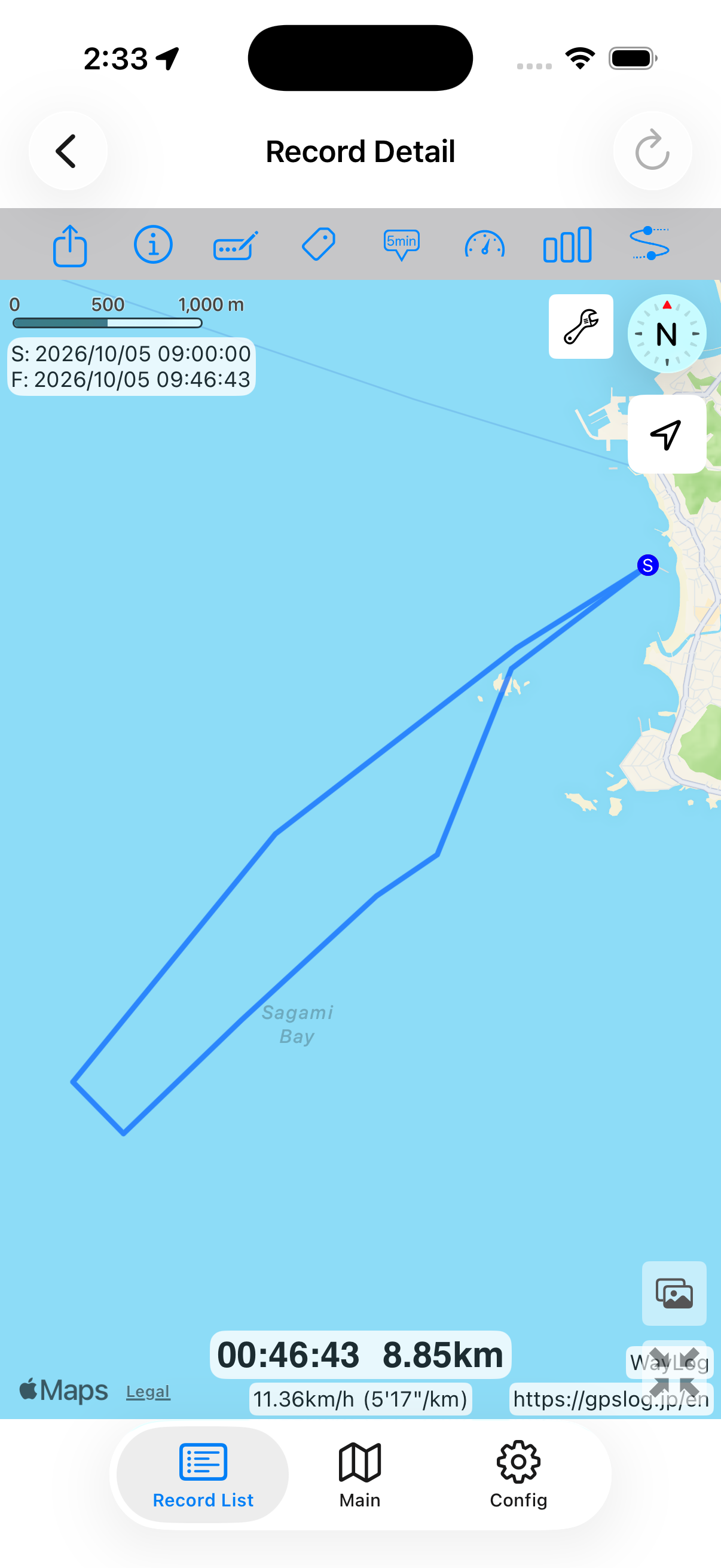
See the route from departure to return. Review the areas you explored and how you moved between fishing spots.
Record sea fishing trips
From harbor to open water and from one fishing spot to the next. Record your boat's route and revisit the day alongside photos of your catch.
Record your journey with WayLogFor iPhone · Free to download
When WayLog can help
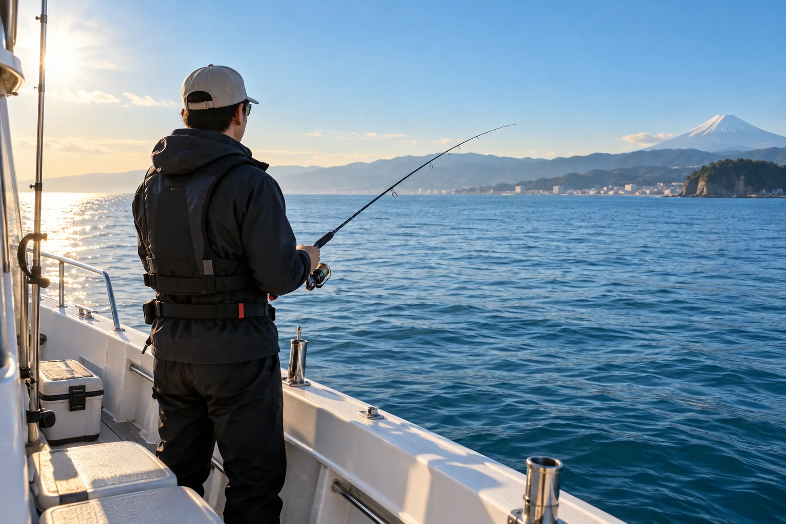
A catch in a photo. A boat moving between spots. Use the route and pictures to help recall where you caught that fish.
See the route from departure to return. Review the areas you explored and how you moved between fishing spots.
Show geotagged photos taken during recording on the map. A catch photo's location can help you remember the area where you fished.
Save the boat's journey as well as fish photos. Remember a day with friends or the first time you caught a new species.
Before your first trip, check compatibility and the settings you need.
Check location settings at the harbor and begin recording before departure. Check your camera's location settings if you want photo locations, too.
Record the boat's route and take a photo when you catch a fish. Check your footing and surroundings, and take photos only when comfortable and safe.
Stop recording and open the boat's route in Record Detail. Use the photo button to show geotagged pictures and revisit the locations alongside your route.
Detailed instructions: Start and stop recording / Show photos on the map
Look back on the map
From harbor to offshore spots and back again. Compare the boat's route with catch photo locations to recall an area that memory alone cannot pinpoint.
A fictional example showing how a record looks. It is not an actual journey or measured distance.
A closer look at your journey
View geotagged photos taken during a recording on its detail map. A photo taken just after a catch can help identify the area. Photo access permission, timestamps, and location data are required.
Keep records your way
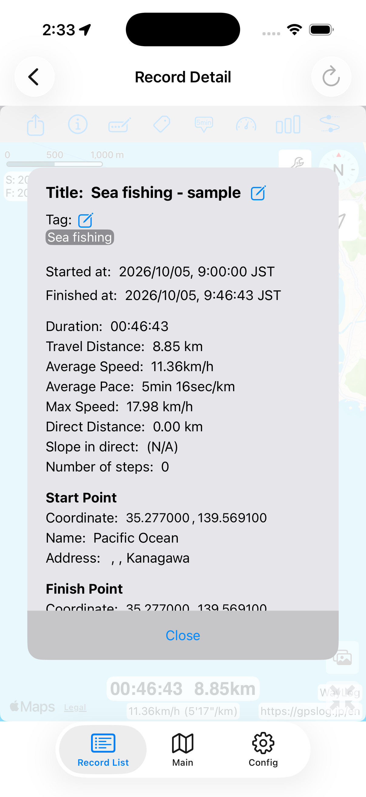
Put the date or boat name in a title, and fish species, tackle, or reminders in notes. Your own Sea fishing or Tai-rubber jigging tags can help you find previous trips.
Example tags you can add yourself
An example of how to organize records. You choose your own tags; they are not assigned automatically.
WayLog does not detect when a fish is caught. Review your route with geotagged photos taken during recording. If a photo is taken elsewhere later, its map location is where the photo was taken.
Check photo access permission, photo timestamps and location data, and whether photos were taken during the recording period. Photos without location data cannot be placed on the map.
This page describes reviewing boat travel and photos. WayLog does not provide fish finding, seabed or depth charts, tide information, or catch predictions.
Use it to review records. It does not replace nautical charts or navigation equipment. Vessel operation should follow appropriate charts and equipment and the captain's judgment.
Map images and GPX files can reveal fishing spots and departure locations. Check them before publishing. If they include locations you do not want to show, avoid sharing them or choose other content, such as a catch photo.
WayLog is free to download and use. Check the App Store and the app for optional features and purchase terms.
No. WayLog cannot recreate a route traveled before recording started. Begin recording before the journey you want to save.
Everyday trips and roads you have never traveled.
Your own records, ready to revisit.
For iPhone · Free to download